Your itinerary
Romantic Long Weekend in Big Sur & Carmel
Three unhurried days along the most photographed 90 miles of coastline in the country, timed so you get Point Lobos before the tour buses, McWay Falls in the gold hour, and a Carmel cottage dinner instead of a Highway 1 pullout. Fewer stops than most planners give you, on purpose.
✓ 14 places checked · July 5💬 3 local consensus picks★ 3 Hidden California picks
Conditions right now
Highway 1 is fully open October 2026, and no CalTrans closures are on record. Fog typically burns off by 10 to 11am this time of year, and mornings are clear more often than July. Nepenthe and Sur House can run 60 to 90 minute waits for dinner on weekends, so the itinerary below reserves ahead where it matters.
Summarized from recent web sources. Always double-check live road status on Caltrans QuickMap before you drive.
Day 1, Friday
Carmel & the reserve at dawn light
Point Lobos State Natural Reserve
The reserve everyone photographs by noon and nobody sees empty. Go at opening instead.
Point Lobos is the place California state parks get compared to, and for once the reputation undersells it. Turquoise coves cut into cypress-covered granite, and the wildlife shows up on schedule: sea otters wrapped in kelp, harbor seals hauled out on the rocks, sea lions barking from Bird Island. Arrive at opening and you'll have the North Shore Trail nearly to yourselves before the first tour van finds a parking spot.
Insider tip
Almost everyone walks straight past the turnoff to China Cove. It's the single most photographed, least visited spot in the reserve. Look for the small unmarked staircase down from the main trail just past the Bird Island parking area. Go in October for the clearest water of the year, and go before 9am on a weekday if you can; midday the main lots fill and rangers start turning cars away.
Reserve entrance fee $10/car, cash or card at the gate. Lots fill by 10am on weekends, so the Bird Island lot is your best bet this early. No permit needed.
≈ 10 min drive
Carmel-by-the-Sea village stroll
Fifteen minutes from Point Lobos and the only real coffee-and-pastry stretch before the coast goes rural for two days.
Carmel's downtown is deliberately small, with no street addresses, no stoplights, storybook cottages tucked between one-off galleries and bookshops. It rewards slow walking more than a checklist. Grab something from a bakery on Ocean Avenue and wander the side streets toward the beach; the town was built to be seen at the pace of two people with nowhere urgent to be.
Metered street parking fills by late morning; the municipal lot at 3rd and Junipero is the reliable fallback. Most shops open at 10am.
≈ 10 min drive
Carmel Beach
White sand, cypress-lined bluffs, and a straight shot down Ocean Avenue: the easiest beautiful hour of the whole trip.
This is the beach behind the village, a half-mile of pale sand backed by Monterey cypress leaning hard away from the wind. It's dog-friendly off-leash under voice control, which explains the local energy, but October crowds thin out fast once you're fifty yards from the stairs. Good for the picnic lunch you should have picked up in town.
Free public parking along Scenic Road, first-come. Restrooms at the north end near 10th Avenue.
≈ 18 min drive
Garrapata State Park (Soberanes Point + Calla Lily Valley)
The bluff-top loop with the best whale and otter sightings on this stretch of coast, and most drivers speed right past the unsigned turnout.
Garrapata has no visitor center, no big sign off Highway 1, just a couple of unmarked gravel turnouts that locals know by mile marker. The Soberanes Point loop is a short, dramatic bluff walk with some of the best whale-watching on the Central Coast in migration season, plus a resident sea otter raft just offshore. In spring the Calla Lily Valley trail (accessed from a different, smaller turnout half a mile south) fills with wild calla lilies down to a hidden beach, but even without bloom the walk down is worth the fifteen minutes.
Insider tip
There's no sign that says 'Garrapata' from the highway. Look for gate numbers 18 and 19 painted on the roadside posts north of the main lot. Locals use those, not GPS, to find the right turnout. Parking is dirt shoulder only and fits maybe eight cars, so a slow pass on the way by beats circling back.
Free, no permit. Turnouts are unpaved and narrow, so pull fully off the white line. No facilities.
≈ 44 min drive
Dinner at Nepenthe
r/BigSur and r/CaliforniaRoadTrip regulars agree it's touristy, and agree you should go anyway for the terrace at sunset.
Nepenthe's food gets mixed reviews and its view does not: a cliffside terrace 800 feet above the water, unbroken coastline in both directions. Locals will tell you it's overpriced and they're not wrong, but they'll also tell you to book the terrace anyway for one sunset per trip, and this is that trip. Go for a sunset-timed reservation rather than peak dinner rush.
Reservations recommended for terrace seating on weekends. Book same-day by early afternoon. Parking lot on-site, fills at sunset.
Day 2, Saturday
The Big Sur coast, bridge to falls
Bixby Creek Bridge
The single most photographed bridge in California, and the light and the tour traffic both favor an early stop.
Bixby Bridge doesn't need an introduction. It's the arch you've seen in a hundred car commercials, 260 feet above Bixby Creek Canyon on a single concrete span. What the postcard doesn't show you is the crowd by 10am, when the vista point turnout fills and cars start parking dangerously along the highway shoulder. Early morning gives you the empty frame and softer light on the arch.
Vista point turnout on the north side has maybe 20 spaces, gone by mid-morning on weekends. No fee, no permit.
≈ 10 min drive
Hurricane Point overlook
The highest, widest coastal view on this drive and almost nobody stops for it because it isn't the famous one.
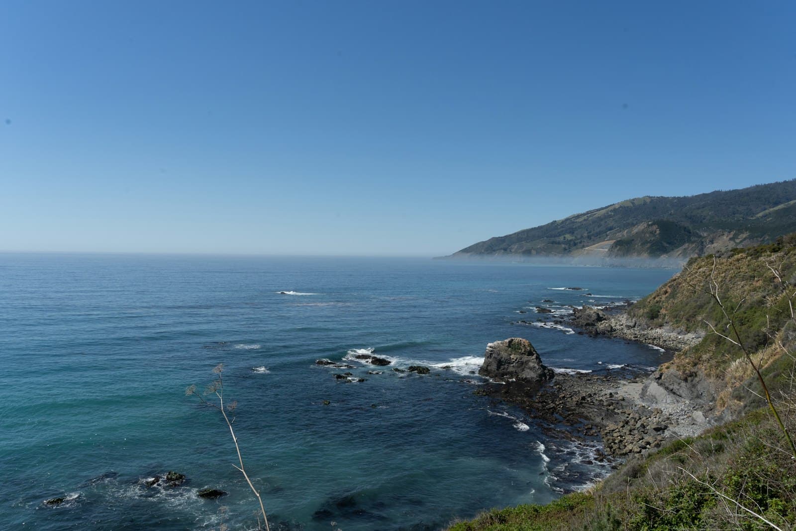
A couple of miles south of Bixby, the highway climbs to its highest point on this stretch and the coastline opens up in both directions: cliffs, whitewater, and no guardrail clutter in the frame. It gets a fraction of Bixby's foot traffic because it doesn't have a name recognition problem, which is exactly the point.
Small unpaved turnout, room for 6 to 8 cars. No facilities.
≈ 10 min drive
Point Sur State Historic Park (exterior view + lighthouse silhouette)
A volcanic rock lighthouse tethered to the mainland by a sandbar. Tours require advance booking, but the roadside view alone earns the stop.
Point Sur Lighthouse sits on a dramatic volcanic rock a quarter-mile offshore, connected to the beach by a sand isthmus, and it's one of the few lighthouses still working its original Fresnel lens. Docent-led walking tours run on a limited weekend schedule and need a reservation days ahead, but even the pullout view from Highway 1, the rock rising straight out of the water, is worth the five-minute stop if you didn't book ahead.
Tour tickets (when running) must be booked in advance through the park's tour calendar; roadside vista point is free, no permit.
≈ 15 min drive
Lunch at Big Sur Bakery
Local consensus pick from r/BigSur for a fast, excellent lunch that isn't a highway pullout sandwich.
Tucked just off the highway in a converted house, the bakery does wood-fired pizza and pastry that keeps coming up in local threads as the lunch stop worth the short detour, especially on a day with a bigger dinner planned. Order at the counter, eat on the porch.
Small gravel lot, fills fast. Arrive before noon on weekends or expect to wait for a spot.
≈ 10 min drive
Pfeiffer Big Sur State Park (redwood grove loop)
Old-growth redwoods a quarter mile from the highway: the shade-and-quiet counterpoint to a day of ocean views.
This is the inland pause in an otherwise coastal day: a short loop through second-growth redwood along the Big Sur River, cool and green even when the highway is baking in October sun. It's an easy, flat walk built for two people who've been driving and want twenty minutes of quiet before the falls.
$10 day-use parking fee at the entrance station. Restrooms and picnic tables on-site.
≈ 21 min drive
McWay Falls, Julia Pfeiffer Burns State Park
The waterfall that drops straight onto sand, viewed from a short, wheelchair-accessible overlook trail. No hike required.
McWay Falls is the improbable one: an 80-foot waterfall falling directly onto a beach that's inaccessible by trail, so you only ever see it from above, framed by cypress. It's an easy fifteen-minute round trip from the parking lot along the Overlook Trail, which makes it one of the few Big Sur icons that doesn't cost you a hike. Midafternoon light keeps the cove out of harsh shadow.
Small lot on the highway shoulder, day-use fee $10 (often collected via iron ranger self-pay). Trail is flat and short, stroller-friendly.
≈ 20 min drive
Dinner at Sur House, Ventana Big Sur
r/MontereyCounty consensus for the splurge dinner: quieter and more romantic than Nepenthe, better food, book ahead.
Where Nepenthe is the view everyone talks about, Sur House at Ventana is the meal locals actually recommend when the trip is about the two of you rather than the photo. It's still a coastal-view dining room, still Big Sur pricing, but the room is calmer and the kitchen more consistent than the more famous spot down the road.
Reservations essential, often 2 to 3 weeks out for weekend prime time. On-site parking for guests.
Day 3, Sunday
Slow morning, coastline home
Andrew Molera State Park (Bluff Trail)
The wide-open bluff walk with almost no one on it, because most visitors never leave the parking lot for the half-mile approach.
Andrew Molera is Big Sur's biggest state park and its least visited, mostly because there's a short unpaved walk-in before you reach anything scenic, which filters out the parking-lot crowd. The Bluff Trail rewards that walk-in with a wide, grassy headland above the water, sweeping views with none of the pullout-photo crowding you got at Bixby.
Insider tip
Skip the river-mouth beach everyone photographs from the entrance and keep walking the Bluff Trail loop another fifteen minutes north. That's where the crowd thins to nobody and the ocean views actually improve.
$10 day-use fee, small lot that rarely fills. Trail is unpaved and can be muddy after rain.
≈ 10 min drive
Coffee and pastry, Big Sur River Inn
A porch over the river for the last unhurried stop before the drive north.
A low-key roadside stop with a deck built out over the Big Sur River, the kind of place to sit for twenty minutes with coffee before getting back in the car. Nothing dramatic, which is exactly the point on a Sunday morning.
On-site lot, rarely full on Sunday mornings.
≈ 29 min drive
Rocky Creek Bridge vista turnout
One last coastal frame heading north, quieter than Bixby a mile up the road.
Rocky Creek Bridge is Bixby's less famous sibling a couple of miles south, a similar arch, a fraction of the visitors. Good for a last five-minute stop before the highway turns back toward Carmel and the drive home.
Small turnout, room for a handful of cars. No facilities.
Some links earn us a small commission at no cost to you. It keeps the trips cheap.